|
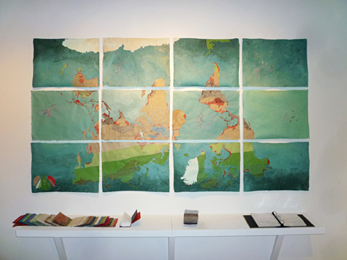
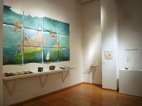
WALL MAP
Future Under Climate Tyranny (F.U.C.T) (A 4° C warmer world)
2011
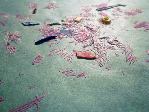
handmade paper (abaca, cotton, flax, wheat straw, beach and desert sand, soil, marine plastic, dried anchovies, dried shrimp, feather boa seaweed, dried garden plants, vegetable seeds, pigment), pva, acrylic
68 x 123 x 1.5 inches (installed)
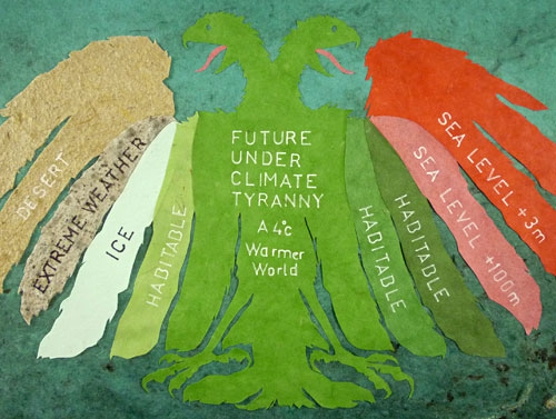
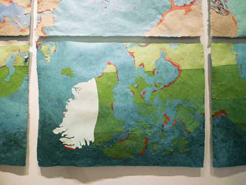
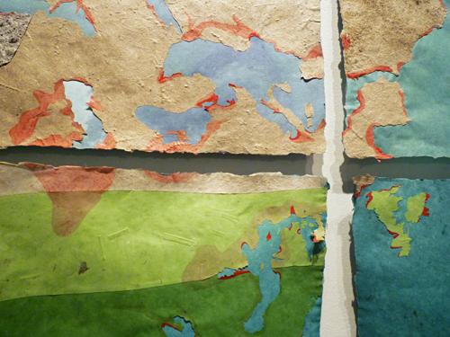
F.U.C.T. is an inverted world map about climate change. Utilizing 11 different kinds of handmade paper with conceptually specific materials this project reveals the possible fate of familiar cities and prospects of unfamiliar territories, changes that will metaphorically turn our world upside down. Based on a map in New Scientist magazine, F.U.C.T. is a map of the future, showing a 4?C warming of surface temperatures. The map is startling; familiar cities are wiped out by desertification and extreme weather patterns, and unfamiliar new territories open up to urban and agricultural possibilities. The map delimitates habitable and uninhabitable zones, serving as a tool for future climate refugees and as a warning to contemporary earthlings.
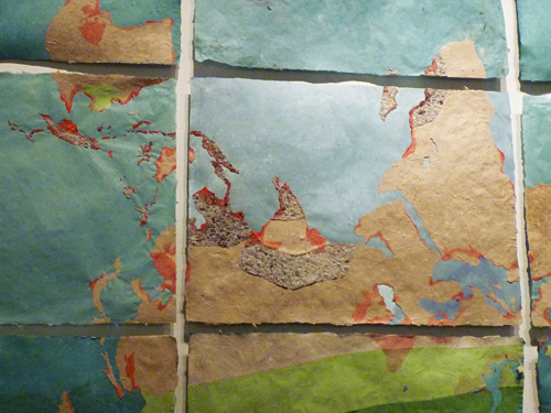
The purpose of F.U.C.T. is to make visible the predictions of climate change. The act of inverting the traditional Mercator projection does three things. First, it urges the audience to see the world differently. Second, it challenges the bias of looking at the Earth in a singular and arbitrary way. Third, it is a metaphor for how climate change will turn the world on its head. The map is constructed of base sheets made of blue-green pigmented fibers representing the oceans. Around the equator warm ocean temperatures will turn the sea into a marine desert, devoid of surface life but spotted with bits of plastic and other marine debris. To represent these marine deserts, translucent overbeaten abaca pulp was lightly pigmented and inclusions of found marine plastic were added. The further north and south one travels, the more life will be able to survive in the world’s oceans. This is expressed with darker pulp, full of nutrients, plant and animal life, represented by the inclusion of found seaweed and dried anchovies. Areas of the Earth that will undergo desertification are constructed with “sand paper”, handmade paper made with naturally colored flax and wheat straw fibers to which found desert and beach sands were added. Areas of the planet that will experience extreme weather patterns are represented with dirt paper, full of chunks of soil and bits of rock. The surface is uneven and representational of the mud likely to be prevalent in the future of these regions. Because global warming will cause a rise in sea level, this map represents a 3-meter rise in bright red paint and paper, the color a warning to inhabitants of these coastal civilizations. Additionally, a 100-meter rise is represented in light red in order to visualize the new contours of our familiar continents. The verdant bands of handmade paper found in the northern- and southern-most regions of the map represent (hopefully) habitable zones. Warmer temperatures here mean possibilities for urbanization and agriculture will increase, drawing new residents recently displaced from desertification, extreme weather, and sea level rise. These areas will be the sites of hope for our future on a warmer planet, but only if humans begin planning for and adapting to the changes ahead.
All landmasses were cut by hand without use of a laser-cutter. Canada alone took 8 hours of focused labor. This method was important to me because it limited the project to a human-scale. The hand and power of the artist is revealed in the cuts, limited and full of human error, adds to the aesthetic of the map as a work of art. When recreating an existing composition, in this case a map of the world landmasses, it is style that gives the work originality. In F.U.C.T., the chosen palette, materials, textures, and processes craft the aesthetic. Each of these elements gives meaning to the work, contributing emotional significance of fear, anxiety, hope, and happiness. The abrasive surfaces of sand and soil stand in contrast to the placid but optimistic shades of green paper. Bold red paint creates a sense of anxiety along the paper coasts. Bright turquoise and deep green waters create an overall sense of serenity to what could be an apocalyptic nightmare. Together these elements provide a tension between hope and fear, optimism and pessimism, representing the current conflict between ignorant resistance and educated adaptation.
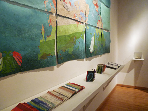
Acquired by Smith College Museum of Art, Northampton, MA. |